Port Hope Land Inventory
Client: Municipality of Port Hope
Partners: Parcel Economics
Year: 2024
Focus Areas: Land Management, Affordable Housing, Economic Development, GIS
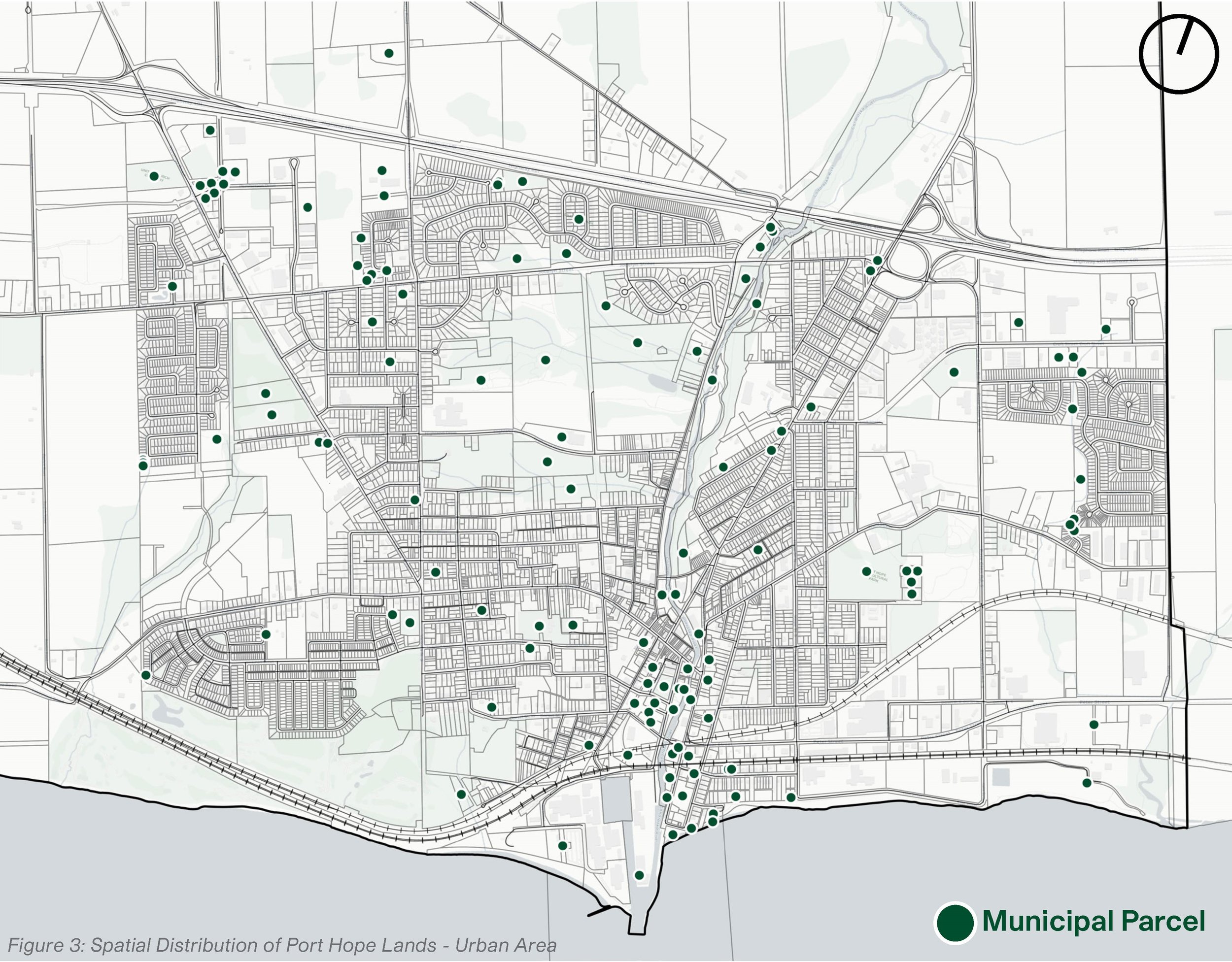
The Municipality of Port Hope holds over 1,250 hectares of publicly owned land—an expansive portfolio that represents 4.5% of its total land area. This includes 338 real property parcels and 669 rights-of-way, ranging from urban infill sites to waterfront access points.
In 2024, the Municipality engaged Re:Public Urbanism and Parcel Economics to lead a comprehensive land inventory project. The goal: build a clear, actionable picture of publicly owned land to support long-term planning, identify opportunities for affordable housing and economic development, and modernize policy tools for managing surplus lands.
Our team developed a centralized, staff-manageable digital inventory and applied a planning lens to assess land value across the portfolio. We identified 26 parcels with potential for surplus designation, six of which—located within the urban fabric—stand out for their ability to deliver near-term community benefit. Of the 669 rights-of-way, eight were flagged for potential disposition, including three with tangible development opportunities.
The outcome is a framework that gives Council the insight to act with purpose. Alongside clear site-level recommendations, we proposed updates to the Municipality’s land management policies, paving the way for a more strategic, transparent, and community-driven approach to public land stewardship.